
Walking a SeaTac Street by Address
Begin with one exact address and build outward. King County eReal can match the site address to a parcel, owner or taxpayer label, and legal description. Parcel Viewer then shows adjoining parcels and address points. Landmark supplies the recorded-document trail. Washington voter sources may confirm public registration facts, subject to use limits and protected-address rules. Older directories or property cards can add a past household clue. None of these sources, alone or together, creates a complete list of occupants along a SeaTac street.
- Enter the normalized address in eReal. Try both the full and abbreviated street type, then save the parcel number and legal description.
- Open the same location in Parcel Viewer. Select nearby parcels, inspect address points and zoning, and export only the fields needed for the search.
- Compare the site address with the tax-statement mailing address. They may differ, and neither proves the named person occupies the building.
- Search Landmark by parcel, owner name, and legal description. Open the newest deed, note the grantor and grantee, and follow the chain back.
- Use voter or historical directory evidence only within its rules. Preserve status, date, source label, and any address variation.
The process is address to parcel, parcel to owner label, legal description to deed, and dated public lists to possible household context. When a result conflicts, the legal description is often more stable than the street wording.
SeaTac Street Directory Search Fields
eReal offers four practical entry routes for by-address work. The result card can include Parcel, Jurisdiction, Name, Levy Code, Site Address, Property Type, Residential Area, plat and lot references, quarter-section-township-range, and Legal Description. Building and land tabs may add year built, square footage, condition, sale history, value, road access, utilities, easements, and restrictions. Those are parcel facts. The field called Name is an owner or taxpayer label, not an occupant list.
| Portal field | What to enter | Street-directory use |
|---|---|---|
| Address | House number and street | Find the parcel tied to a site line |
| Parcel | King County parcel number | Hold the same land unit across records |
| Owner or tax account | Name on the county roll | Find other parcel labels for the same name |
| Condo or apartment | Recorded property name | Locate a complex or unit route |
The eReal property portal shows the live search choices used for SeaTac.
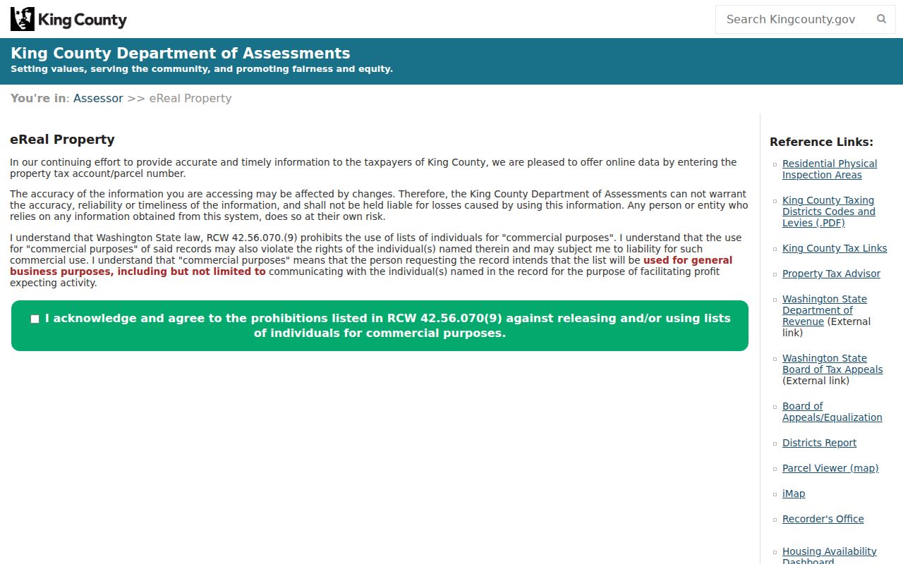
The interface confirms why an address search should be followed by parcel and name checks, not treated as a one-box answer.
Site and Mail Addresses Differ
A SeaTac street directory needs two address columns. The assessor's Site Address identifies the parcel location. The King County tax statement carries the taxpayer mailing address. An owner may receive mail at another property, a post office box, or an administrative address. A parcel can also lack a simple site line while retaining a legal description. Copying the mail label into an occupant field creates a false residence claim.
Keep the original labels in notes: site or situs address, tax mailing address, owner or taxpayer name, and parcel number. Situs means the physical place assigned to the parcel. A mailing address tells the county where to send tax notices. If the two match, that is still only a match between official fields. It does not identify every person in the building.
Note: Apartment and condo names have their own eReal route, but unit labels and common parcels can require extra care.
Map a SeaTac Block Carefully
King County Parcel Viewer searches by parcel number, address, or condo name. In Parcels mode, a user can select one or more parcels, export selected data, and toggle zoning and address points. That makes it useful for moving from one SeaTac address to the next along a named street. The map warns that it is not a survey, may change, and cannot be sold without written permission. Boundary lines should be treated as planning and research context, not a legal boundary finding.
iMap adds address, parcel, intersection, and place or landmark search. It also offers enhanced search, thematic layers, multiple basemaps, aerial vintages, topography, lidar, and parcel pop-ups. Aerial dates and layer dates can differ. Save the layer name and date used. Planning materials also name Angle Lake, Bow Lake, Grandview, Madrona, Mansion Hill, Maywood, McMicken Heights, River Ridge, and Riverton Heights. These are useful map facets, but not all are formal associations.
SeaTac Street Records and Coverage
Address-keyed sources overlap without saying the same thing. The street directory is strongest when each source is assigned one task and its limits are kept beside the result.
| Record Set | Keeper | What It Shows | Access |
|---|---|---|---|
| Property and tax roll | King County Assessor and Treasury | Site, owner or taxpayer label, mail address, parcel facts | eReal and tax statement |
| GIS parcel map | King County GIS | Nearby parcels, address points, zoning, map layers | Parcel Viewer and iMap |
| Recorded instruments | King County Recorder and Archives | Deeds, easements, plats, liens, and legal descriptions | Landmark; Archives for older files |
| Voter records | Washington Secretary of State | Statutory public registration fields | VoteWA or regulated extract |
| Permits and code files | City of SeaTac | Project, notice, and address-linked public records | LAMA or a city request |
The parcel number ties the assessor to map data and many recorded instruments. The legal description reaches farther back when parcel indexing fails. The street wording ties permits, notices, voter material, and old directories to the place, but older SeaTac labels may shift. Save all three keys.
Follow SeaTac Deeds by Legal Description
Landmark's free search covers names, document type, book and page, consideration, recording number, parcel ID, record date, legal descriptions, and advanced legal fields. Most images recorded on or after August 1, 1991 are online. The general index reaches 1976, but the older portion usually has basic index facts without images. Parcel search pulls roughly 1997 to current records and can be inconsistent in earlier years. For 1852 through 1975, use the King County Archives Grantor-Grantee microfilm by name and date.
Start with the newest deed. Record the grantor, grantee, recording number, date, and legal description. Search the prior grantee as the next grantor, then repeat. Easements, covenants, rights-of-way, and plats may explain access or parcel shape without transferring ownership. A Landmark image is unofficial. Ask the Recorder for a certified copy when the document itself must be relied on.
The Landmark index exposes the search tabs used in that chain.
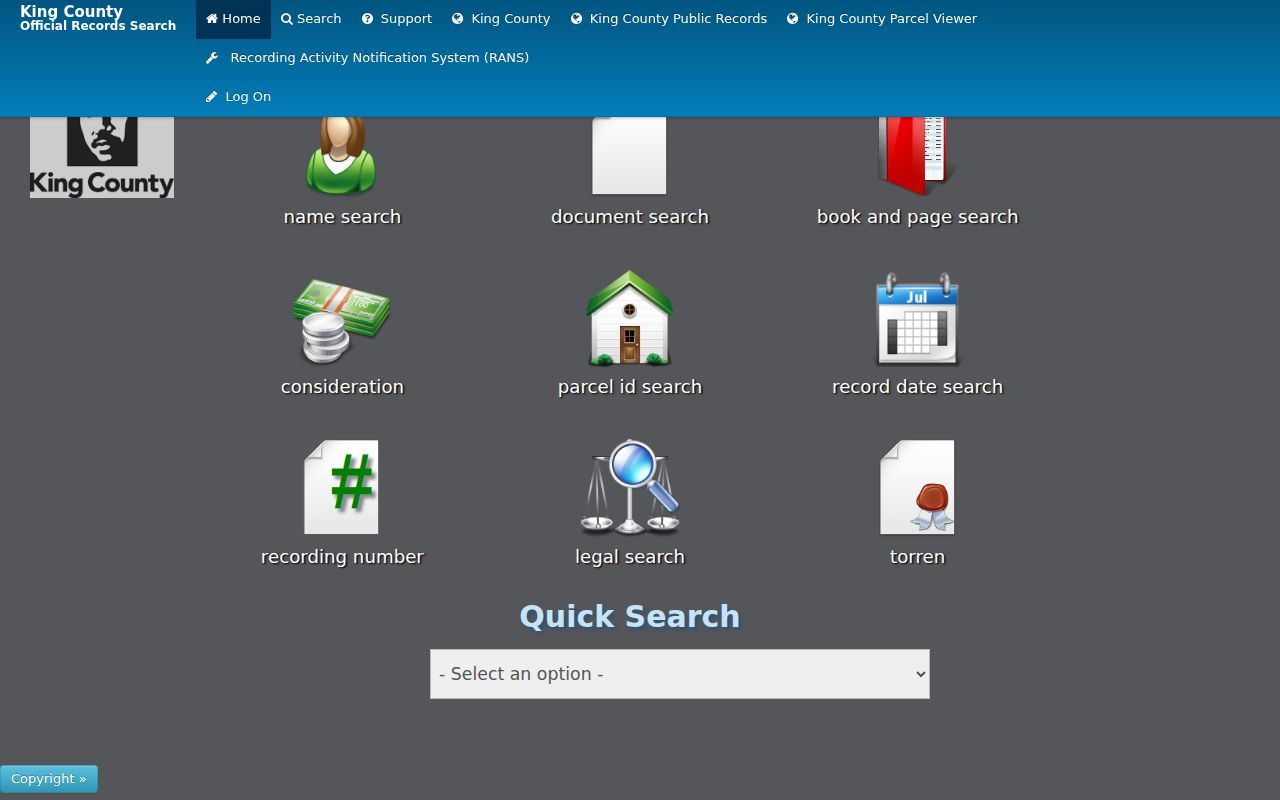
The range of tabs supports a second search by name or legal description when a parcel query returns too little.
SeaTac Permits Follow the Address
The City of SeaTac's LAMA system is the local permit route. Its visible navigation includes Pay, Apply, Report, Your Items, Contractor Status, Advanced Search, Inspections, and Open Data. City permit types include building, drainage, electrical, grading, lot-line adjustment, plumbing, right-of-way, shoreline, short plat, rezone, fire suppression, fuel-storage tank, and other project categories. The dynamic public fields and full historical span were not confirmed, so do not promise a filter that is not visible in the live portal.
If LAMA does not expose the needed file, use the SeaTac public-records request route. Supply the exact address, date range, permit or project type, and known names. Requests may be made through the online portal, in person, or by letter, email, fax, or phone. The city gives an initial response within five business days. Code records also use the exact violation address and details, while some requester information may be protected.
SeaTac Roads Carry Older Names
Present-day SeaTac became a city after a 1989 vote and formal establishment in 1990. Earlier records may use Highline, Angle Lake, Bow Lake, McMicken Heights, Riverton Heights, Sunnydale, Seattle, a postal place, or a township and range. International Boulevard was formerly Highway 99 in the city. Military Road S and Des Moines Memorial Way also appear as long-lived corridor clues. A failed modern-street search should branch into those older labels.
Build a same-address timeline with the directory wording, property-card legal description, deed description, assessor site address, tax mailing address, ZIP result, and current planning-area label. That reveals changes without guessing at why they occurred. Airport-area records form their own layer because Port, city, county, permit, and transport files can all describe the same place. An airport address should not be read as ordinary household evidence.
Older SeaTac Streets Need Archives
Puget Sound Regional Archives property cards can bridge the modern parcel screen and an older street. Regional cards from roughly 1937 through 1972 may show legal description, building type and use, rooms, construction details, assessed value, and one or more photographs. King County Archives keeps older recorded documents, maps, and land-use material. Its research room is at 1215 E Fir Street in Seattle, and remote consultations and scans may be possible. Many collections benefit from an appointment, though recorded-document microfilm does not require one.
Seattle Public Library's digitized regional directory shelf spans 1867 through 1940, and physical Seattle directories run from 1890 through 1990. A 1928 house and street directory offers a reverse address route. Valley View Library can help identify microfilm, newspapers, genealogy databases, and obituary sources, while Highline Heritage Museum holds oral histories and Highline Times volumes. The collection-level detail belongs in the SeaTac Directory Book, but a street search should use the shelf when a current label disappears.
The King County property-history guide shows the archival route.
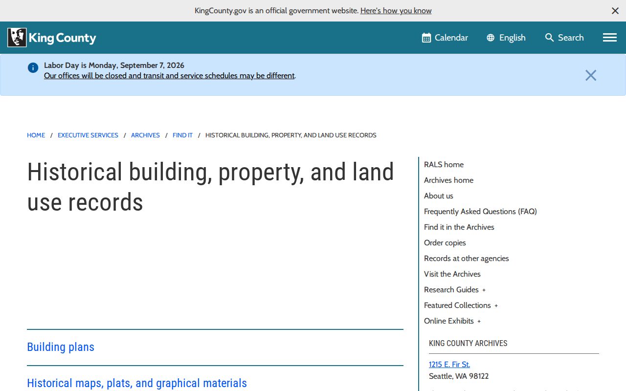
The archive source helps carry a street directory search past the online deed-image cutoff.
SeaTac Street Terms Defined
A few record terms keep by-street notes precise.
- Parcel
- A unit of land tracked by the assessor; it is not a household or building resident list.
- Situs address
- The parcel's physical site address, which can differ from the taxpayer mailing address.
- Plat
- A recorded map that divides land into lots, blocks, streets, and easements.
- Legal description
- The formal land description used in deeds, often more stable than a street name.
- Criss-cross directory
- A directory arranged by street or phone number, useful for a dated reverse lookup.
Keep the term beside the value in research notes. That small step stops a plat lot, tax mail line, and current site address from being merged into one claim.
Limits of a SeaTac Street Directory
A map cannot prove a boundary on the ground, and an assessor record cannot prove who lives in a home. Recorded instruments show parties and land interests. Voter data covers only registered voters and can carry an inactive status or a protected substitute address. Permit records may name an applicant, owner, contractor, or project contact. Old directories are snapshots with spelling, coverage, and publication gaps. A street directory should preserve those roles rather than turn them into one resident list.
Washington's Address Confidentiality Program protects actual residence, city, county, and precinct information for eligible participants. The public substitute address must not be reverse searched. Public voter extracts also have strict use limits. When a source withholds a field, the gap is a boundary, not an invitation to infer it from relatives or nearby parcels.
Lawful use. Use SeaTac address records only for a lawful personal purpose. Never use them to expose a protected address, stalk, harass, intimidate, or harm a person.