
SeaTac Neighbor Records by Block
Public sources describe different parts of a block. Parcel tools show land and owner or taxpayer labels. Plats explain lot structure. Planning maps supply public area names. Directories and newspapers can document an older street at a date. None is a live list of every person in each home.
| Source | What it shows about a block | Access |
|---|---|---|
| King County Parcel Viewer | Adjacent parcels, address points, zoning, geometry, selected groups | Free online map |
| King County iMap | Roads, aerial views, terrain, landmarks, themed layers | Online; check layer dates |
| Recorder plats and easements | Lots, shared access, utilities, restrictions | Landmark or Archives |
| Historical property cards | Building form, photographs, assessment context | Puget Sound Regional Archives |
| SeaTac planning maps | Planning areas, station hubs, corridors | City documents |
| Directories and newspapers | Dated names and businesses tied to a street | Libraries and museum |
An owner's mailing address can differ from the parcel's site address. Occupants, relatives, and visitors are not established by an assessor record. State voter data may confirm certain public fields, but it is not a census of a block.
Choose the smallest area that answers the question. An adjoining-parcel task may need only three or four assessor checks. A shared-drive question belongs in a plat or easement. A planning issue calls for a city map and meeting record. Older block history may need a directory, aerial image, or newspaper. Expanding every inquiry into a list of names adds risk without improving the result.
Map SeaTac Neighbors Parcel by Parcel
King County Parcel Viewer searches by parcel number, address, or condo name. In parcel mode, a user can select one or many parcels and export selected public data. The safest workflow expands only far enough to answer the block question.
- Locate the known address in the King County Parcel Viewer.
- Confirm the selected parcel's shape and site address before clicking any neighbor parcel.
- Select the parcels that directly touch it or face it across the street. Record parcel numbers and public owner labels.
- Use eReal to verify each parcel's jurisdiction, legal description, and current owner or taxpayer label.
- Stop at the defined block. For a full named-road chain, use the SeaTac street directory.
Parcel Viewer is not a survey and county data can change. Its lines aid research but do not decide a boundary dispute. If shared access is the issue, inspect the recorded plat or easement instead of relying on map appearance.
Exported parcel data should remain a working note, not a published household list. Record only the fields that answer the question, such as parcel number, site address, legal description, and public owner label. Then return to the live assessor page before relying on an older export. A current tax statement may also show a mailing address, but a mismatch with the site address does not prove that an owner moved or that another person lives on the parcel.
SeaTac Neighbor Layers and Aerials
Parcel Viewer can toggle zoning and address points. King County iMap goes further with intersection and landmark searches, themed public layers, topography, lidar, and aerial basemaps from different vintages. Those tools help explain the setting around SeaTac neighbors without claiming facts about a private household.
Aerial views may show when a road, structure, or access route changed. Zoning gives the public land-use category. Address points help test whether a map label sits on the expected parcel. Each layer has its own update date, so save the date and layer name with a finding.
Shared drives and access tracts require recorded evidence. The King County Recorder search covers plats, easements, rights-of-way, and covenants. Landmark usually supplies images from August 1, 1991 forward; older documents route to Archives.
SeaTac Neighbors and Planning Names
SeaTac planning materials identify Angle Lake, Bow Lake, Grandview, Madrona, Mansion Hill, Maywood, McMicken Heights, River Ridge, and Riverton Heights. Current plans also use North, Central, and South areas plus hubs near 154th Street, City Center/Airport District, and Angle Lake.
These names are strong search facets for meeting minutes, plans, oral histories, and local news. They are not all formal neighborhood associations. Say “planning area” or “community label” when that is what the source supports. Do not infer that every parcel within a mapped label belongs to a private group.
| Adjacent neighbor | A parcel touching or facing the starting parcel |
|---|---|
| Block neighbor | A parcel within a stated street segment |
| Planning-area neighbor | A site sharing a city planning label |
| Civic neighbor | A public organization active in the area |
Defining the word before searching prevents a broad community label from becoming a false claim about one household.
Public Voices Among SeaTac Neighbors
No official umbrella association directory or complete HOA member list was found for SeaTac. The public community layer instead comes from city boards, meeting records, and organizations named in city cultural material. These sources show public participation or institutional roles, not private residence.
City boards
Arts/Culture/Library, Community Services, Hotel/Motel Tax, Planning Commission, Senior Citizen, and Tree Board records may identify public participants and issues.
Community partners
City material names Global to Local, Somali Youth and Family Club, South King County Cultural Coalition, and Congolese Integration Network.
Service organizations
Lutheran Community Services Northwest and Somali Health Board appear as public community-resource leads.
Use the SeaTac City Clerk for agendas, minutes, ordinances, and committee records. Link an institution's public role. Never infer a person's faith, ethnicity, membership, or home from an organization's location or a meeting appearance.
Older SeaTac Neighbors in Highline
SeaTac incorporated in 1990, so older block history often sits under Highline or a predecessor community. The Highline Heritage Museum holds local photographs, school and airport material, Highline Times volumes from the 1940s to the early 1990s, and more than 300 reported oral histories. That record can explain a block's past without pretending it supplies a current roster.
Consult the Highline Heritage Museum collection page before reviewing the captured source.
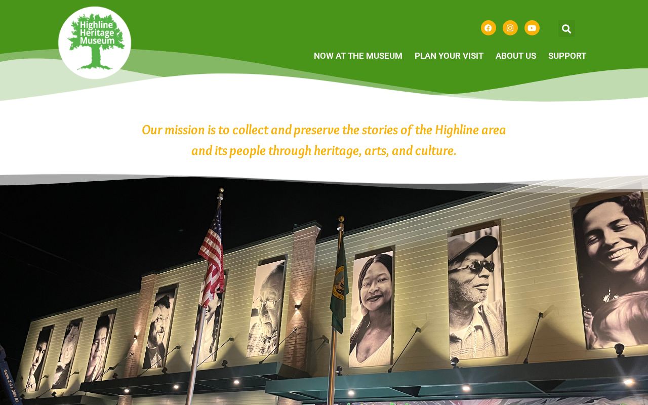
The image supports a focused research request built around a street, approximate year, surname, school, or community label. Seattle Public Library directories and KCLS genealogy help can then supply dated address clues.
International Boulevard may appear as Highway 99. Airport growth and road changes can also move the documentary trail among city, county, Port, and newspaper sources. Preserve each historical name rather than applying today's map label to every era.
Official SeaTac Neighbor Sources Compared
Official rolls are narrower than commercial neighbor tools, but their scope and custodian are visible. Commercial compilations may merge old addresses, phones, and unrelated people without showing the source date. Use them, if encountered elsewhere, only as unverified clues.
| Source type | Strength | Limit |
|---|---|---|
| County parcel and assessor | Official parcel and owner/taxpayer fields | Does not list every occupant |
| Recorder documents | Recorded parties and legal land facts | A party may never have lived there |
| Planning and civic records | Dated public context and participation | Not an association roster |
| Commercial compilation | May suggest a name or past address | Can be stale, merged, or unsupported |
Good block research records the source, date, exact label, confidence, and unresolved alternatives. A not-found result is better than attaching the wrong name to SeaTac neighbors.
SeaTac Neighbor Voter-Record Limits
Washington law makes voter name, address, political jurisdiction, gender, birth year, voting record, registration date, and registration number public under RCW 29A.08.710. Full birth dates, Social Security numbers, driver-license data, original forms, and protected addresses are withheld. Public precinct lists remain subject to statutory limits on advertising and solicitation.
A voter row confirms only what the official record says at its update date. Active or inactive status is not occupancy proof. A person may use a separate mailing address, and an Address Confidentiality Program participant's actual city, county, residence, and precinct are protected. Never use nearby parcels or district clues to reverse-engineer a protected location.
The statewide voter extract is updated monthly and normally delivered after an approved request. King County Elections remains the local records contact for county election material. Any block-level use must follow the Secretary of State terms and RCW 29A.08.720, including the ban on using lists for advertisements or solicitation. A narrow jurisdiction check is usually enough; full voter rows and registration numbers do not belong in a public neighbor roster.
Note: Use the fewest public fields needed to resolve a lawful block question, and never publish a voter extract as a neighbor list.
Privacy for Your SeaTac Neighbors
Utility accounts, delivery records, private association rosters, and unlisted household members are not public block data. The assessor's “Name” is an owner or taxpayer field. A tax mailing address may be elsewhere. Court and vital records have their own limits and should not be mined to flesh out a map.
The Washington Address Confidentiality Program provides eligible survivors and protected groups a substitute address and mail forwarding. Respect the substitute record. Do not seek the actual address from neighbors, precinct data, parcels, or social posts.
Lawful use. Look up SeaTac neighbors for block context, reconnection, civic curiosity, or personal safety. Never watch, intimidate, contact, doxx, threaten, or harass someone because a public record points nearby.
Keep a short source log for every block finding: the portal or collection, layer name, record date, access date, exact public label, and confidence. Separate what the record states from what it merely suggests. If an owner name, postal city, and planning area do not align, leave the conflict open until the parcel, deed, or custodian resolves it. That is safer and more accurate than forcing a neat roster of SeaTac neighbors.